
Services
• Forever focused on solutions •
We at GSL are driven by the human zest to solve complicated problems. Share your challenges with us and let us design a comprehensive, holistic and efficient solution.
--
Executing aerial photography missions, especially in remote locations, is complex. In order to simplify the process, we use local logistics partners to coordinate flights, locate aircrafts, obtain flight permits, arrange for fuel transit, allow onsite maintenance, ground support, and many other necessary arrangements. We plan ahead in order to enable a smooth operation, and fast delivery. We would like to work with companies that understand the importance of logistics for a successful project, and have the ability to implement it in their home court.
--

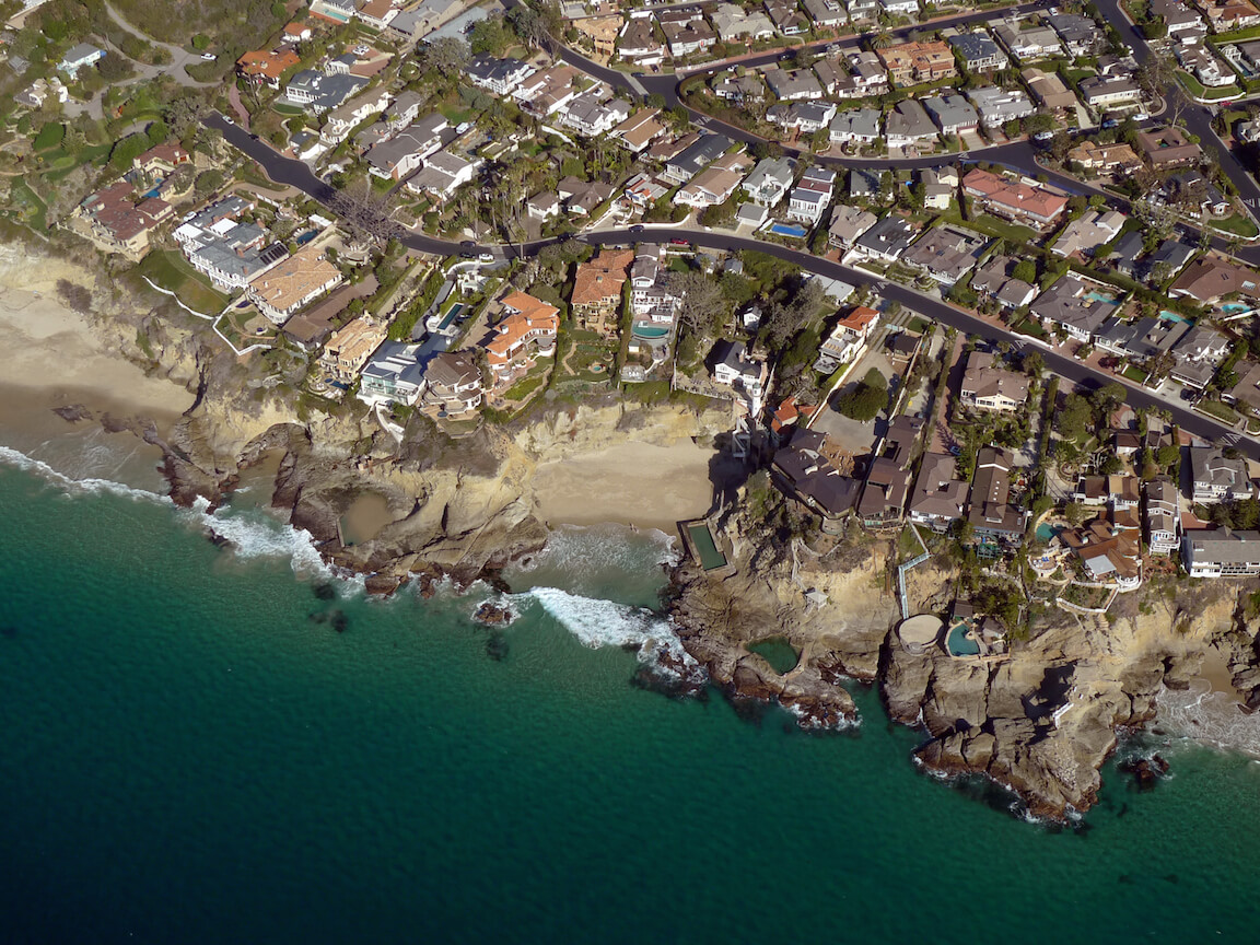
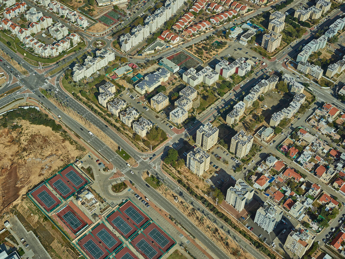
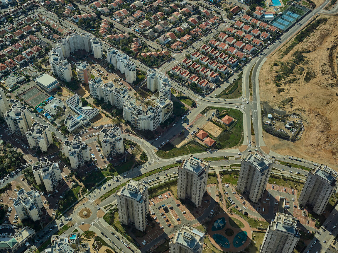
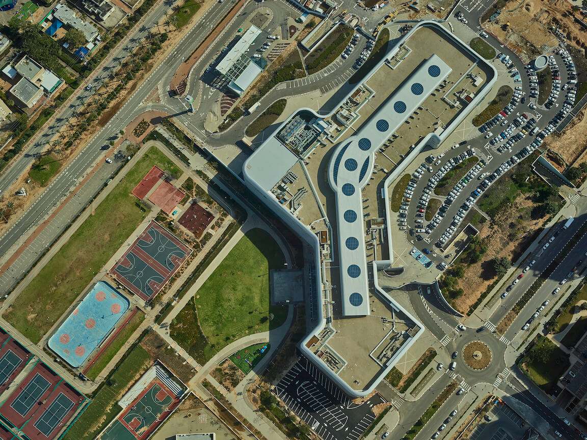
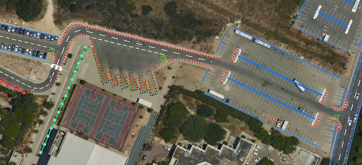
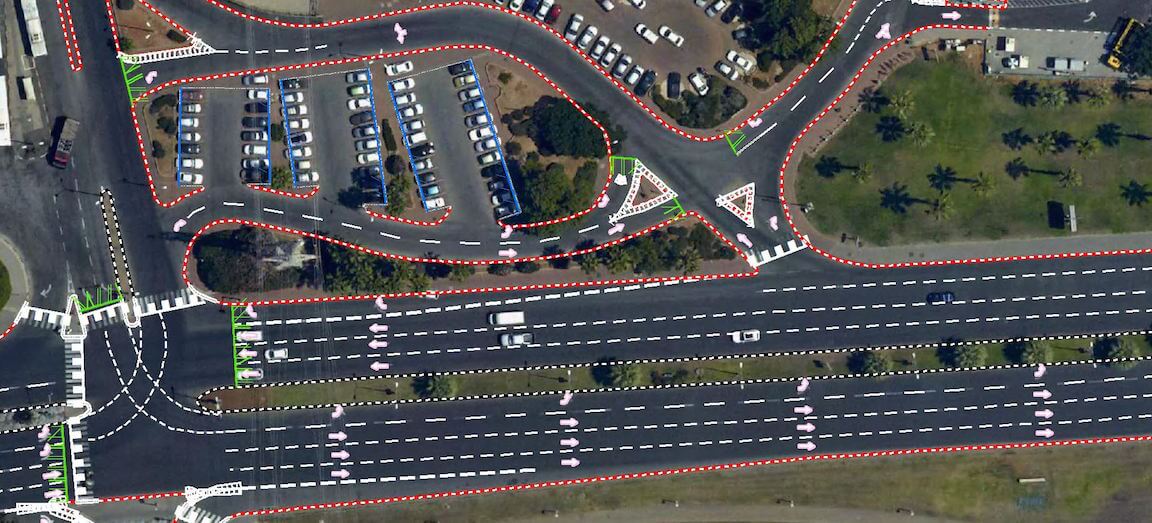
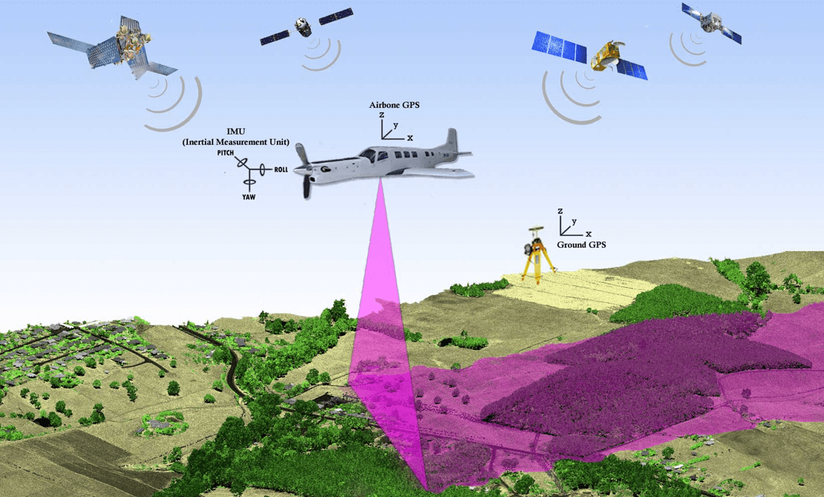
Nadir & Oblique Imagery
Accuracy is Key.
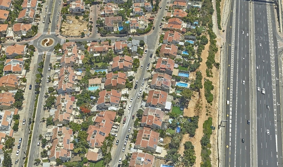
We have an in-house capability of capturing and processing true ortho-photo and oblique images with accuracy as high as a few cms. Our USP lies in our speed of capture which is upwards of 100 sq kms per hour. If you are fed up of using stale and coarse satellite imagery, please get in touch to avail a free demo of digitizing and coding ease on a high resolution base map.
‣ Nadir and Oblique, geo referenced images, up to 5cm GSD
‣ Stereo pairs
‣ Ortho images
‣ OrthoMosaics - up to 5cm GSD
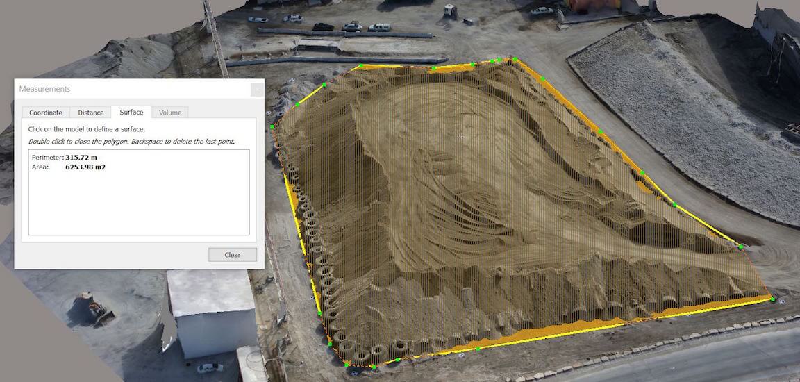
‣ Volume calculation using point cloud analysis.
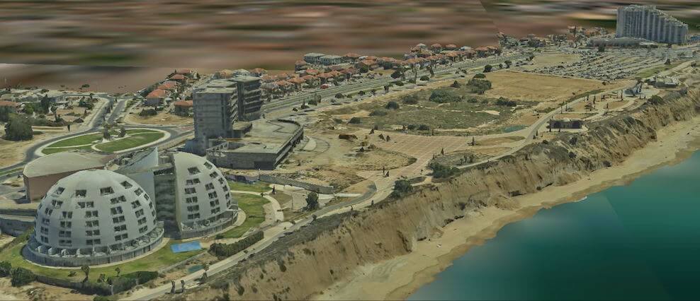
3D Mapping
We have an in-house capability of capturing and processing 3D data with accuracy up to 5cm using automated photogmetric algorithms and a state of the art 3D mesh engine.
Our aerial image capture solution is the most sought after in the world for its efficiency and ease of use. Experts with over two decades of experience can help solve the most complex images using propitiatory algorithms and softwares.
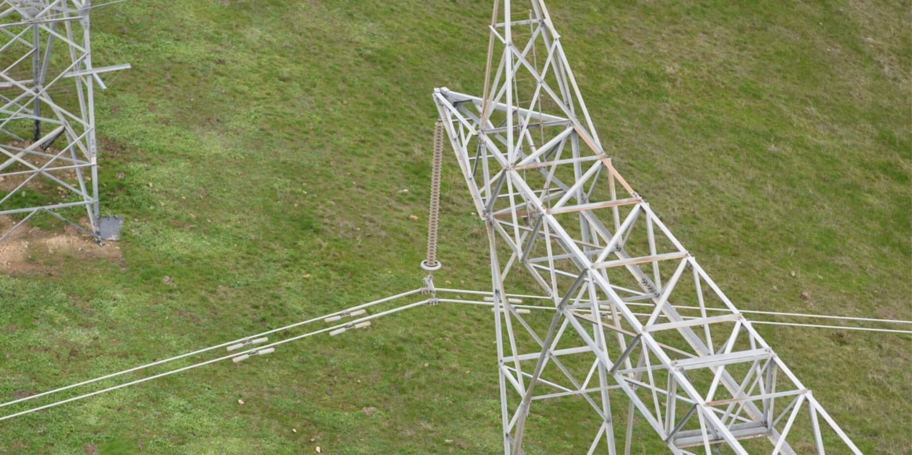
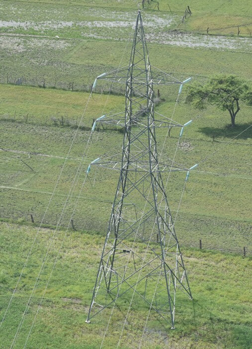
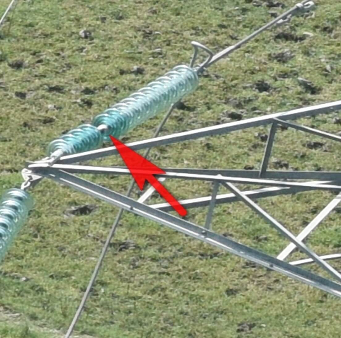
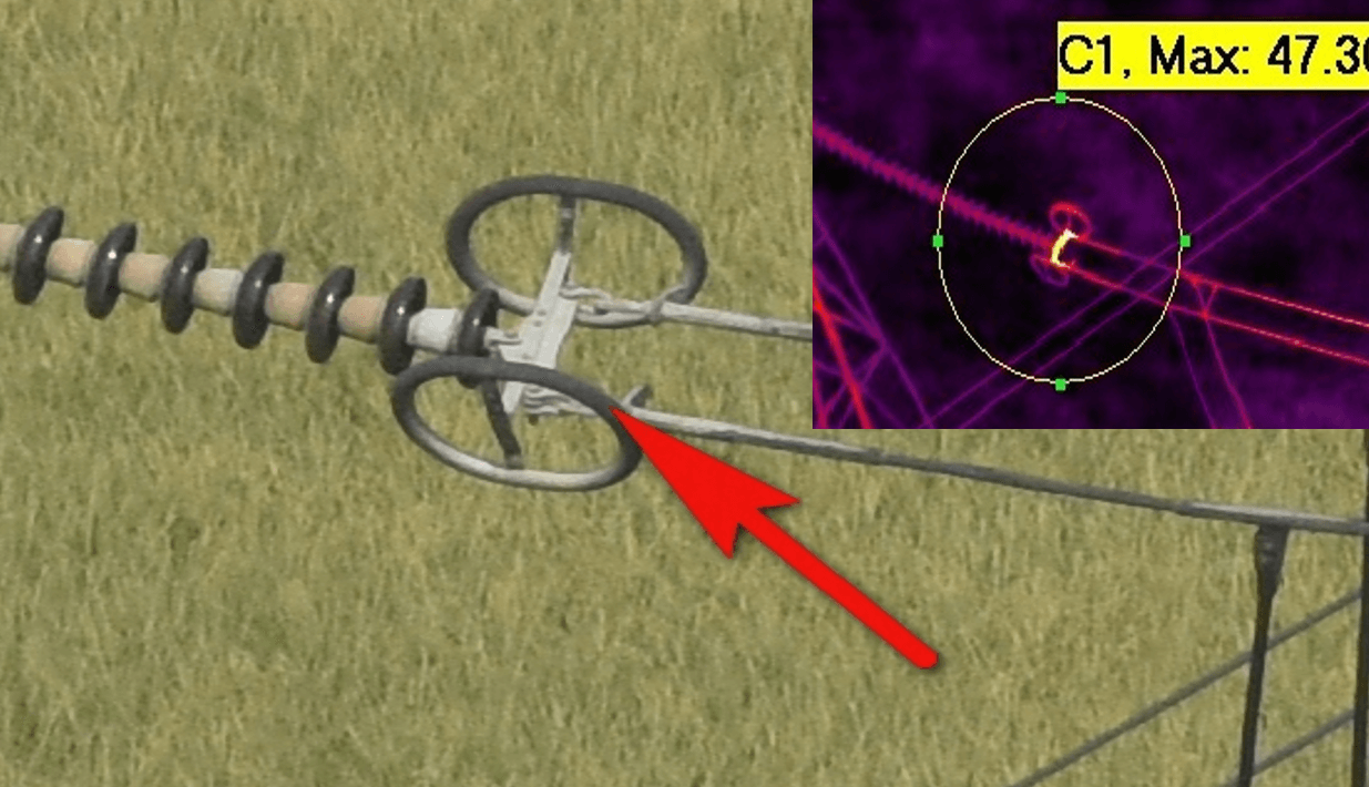
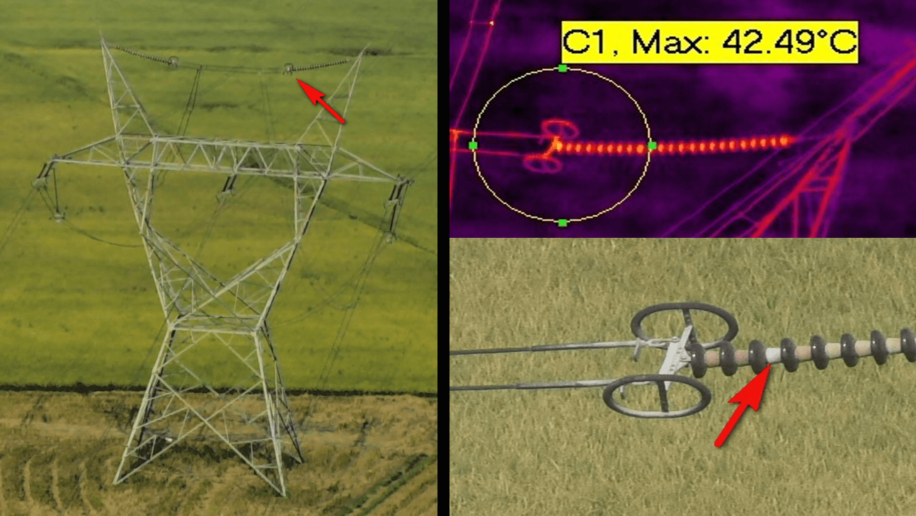

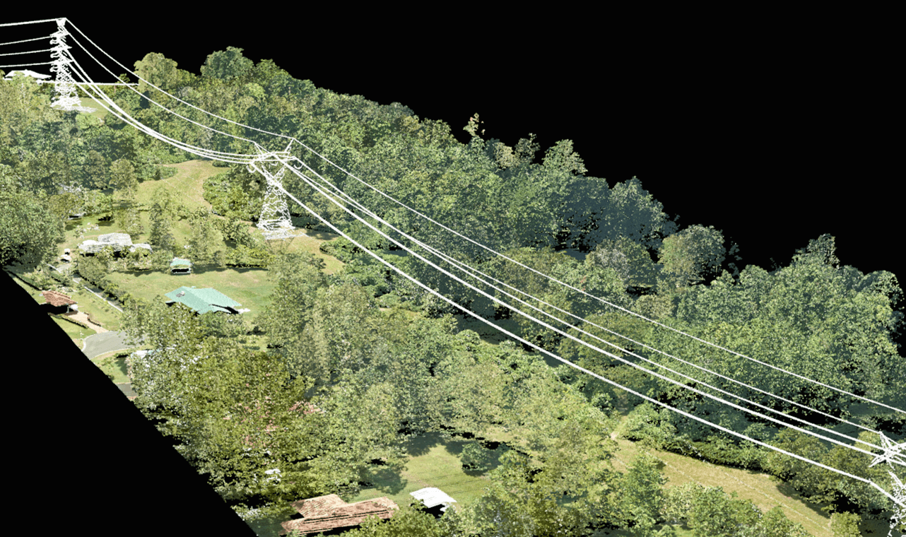
Utility Inspection
Be it roads, gas pipelines or power transmission lines, we at GSL have the experience and expertise to inspect and manage your assets with tangible results.
If you're an asset owner that is looking for using GIS tools and Aerial Surveillance of your asset, please get in touch to receive a free demo.

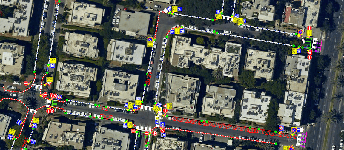
Data processing
GSL has the entire photogrammetric workflow and expertise in-house. We employ a bundle of software packages, together with our own proprietary algorithms to enable fast, accurate processing and delivery.
‣ We specialize in 3D oblique processing and Ortho mosaic of small frame images
‣ Handling tens of thousands of images from any sensor and image size
‣ Under 1 pixel RMS geometric solution
‣ Calibration services and self calibration methods
‣ Integrating Lidar data and GCP's
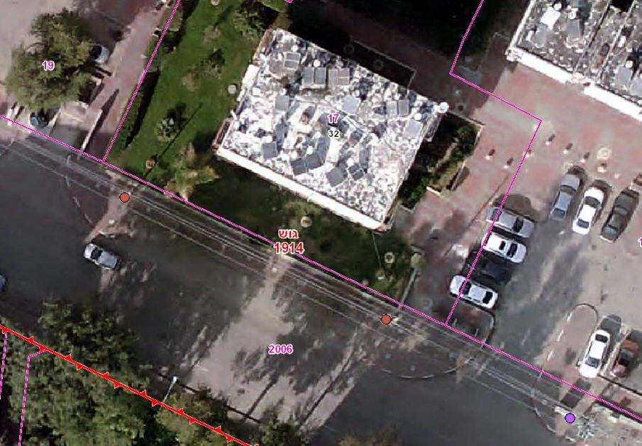
‣ Digitizing as per reality on 2D or 3D maps
‣ Cross platform processing ability. ArcGis, QGis, Microstation, Context Capture, Skyline, etc..
• • •
Technology
Technology is the application of scientific knowledge for practical purposes and one size does not fit all
We at GSL, are focused on using the most efficient technology and tools to help solve complex problems. Our out of the box approach helps us fuse and mate the best solutions from all over the world to cater to the unique needs of each project.
Our efficient technology and flexible operation enable us to offer solutions to many industries that have yet to exploit the benefits of aerial survey and mapping.
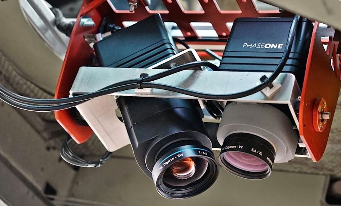
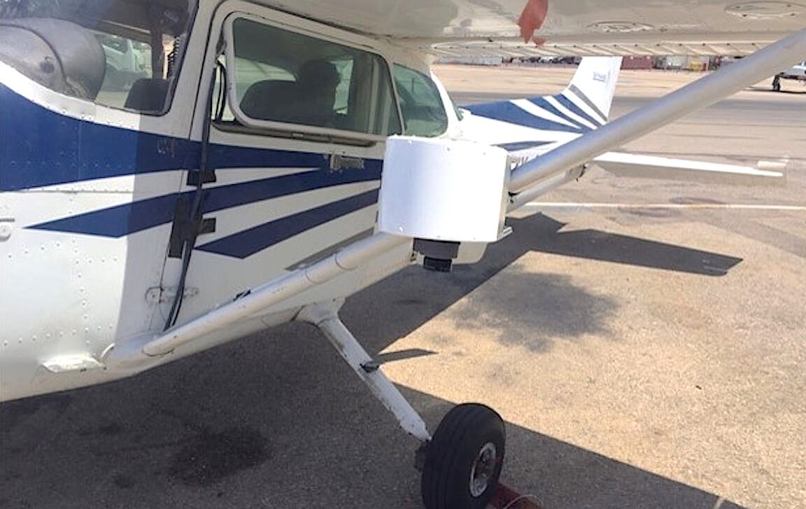
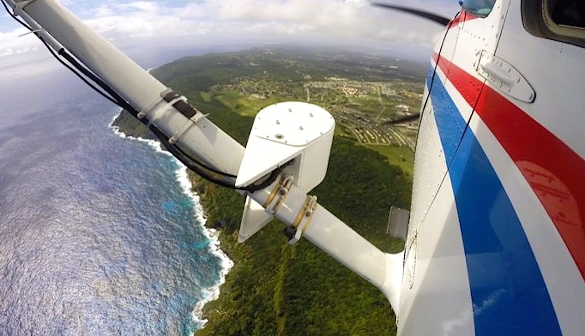
Aerial image capture (sweep)
3D Data Acquisition – Large swath on a miniature device.
Innovative dual sweepcamera systems, combined with state of the art photogrammetric tools, enable new aerial mapping capabilities. With various installation options its one of the most effective mapping tools out there.
‣ The sweeping camera system can operate several cameras: PhaseOne IXU-R1000 - 100MP, IXU 150 or Cannon 5DSR - 50MP.
‣ System collects up to 8 images per 3 seconds, moving in perpendicular to the aircraft direction.
‣ Nadir and two sides oblique collection in achieved in one flight pass. A full sweep creates a 300mp large size frame that aggregates 36,000 unique pixels across track (3.6km swath in 10cm GSD).
‣ These individual images are later processed to create large frame image per sweep, flight lines and full mosaic.
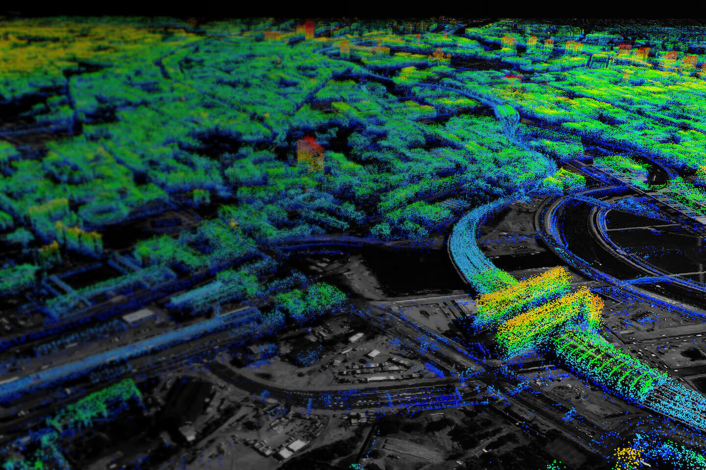
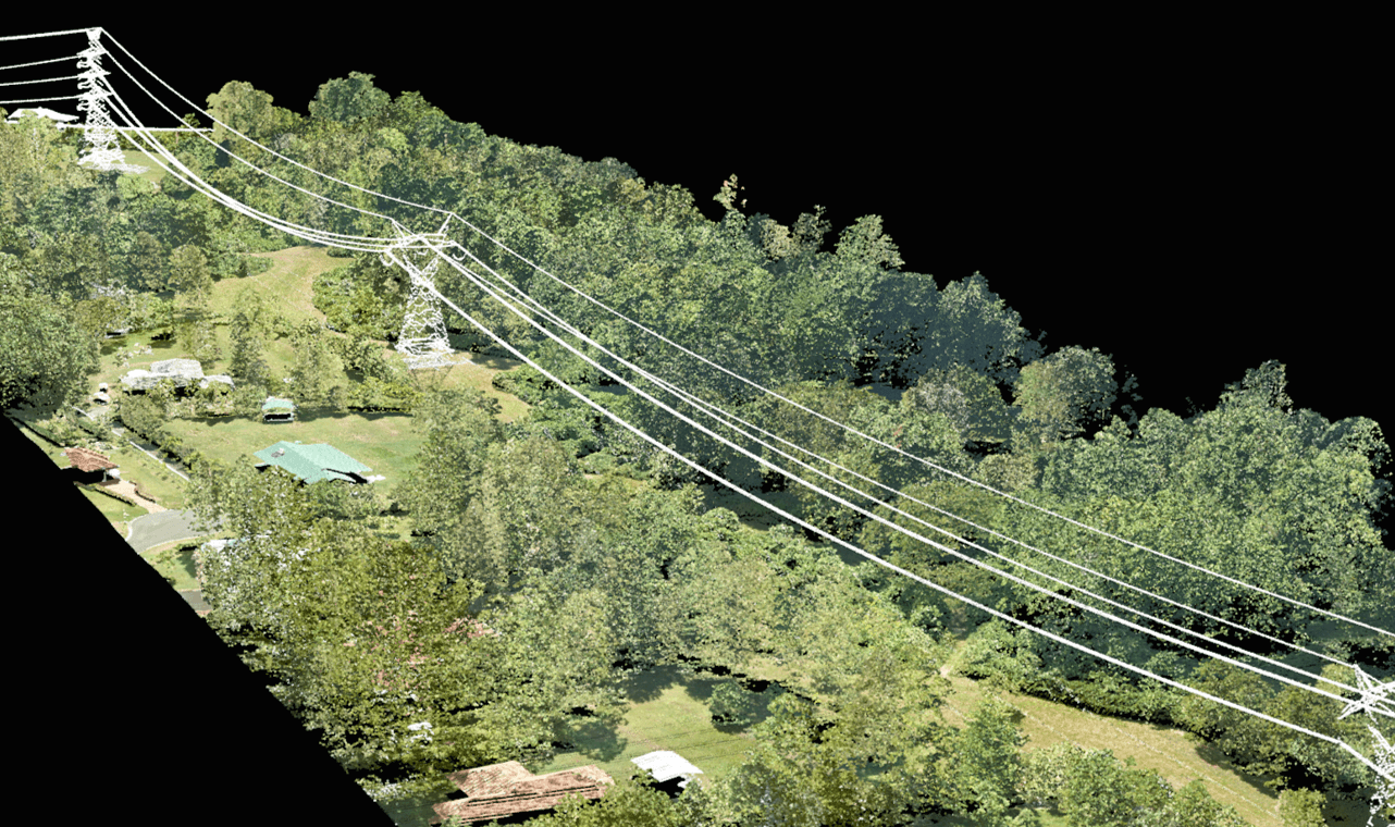
Aerial & mobile lidar
Aerial LiDAR (Light Detection and Ranging) is aerial mapping technology that uses calibrated laser returns from the earth’s surface are reflected to an overflying GPS-monitored aircraft equipped with on-board positional and IMU sensors. After post-flight production processes, the acquired LiDAR Map data determines the precise elevation and geospatial location of features on the earth’s surface. With innovations such as multiple intensity returns and increased pulse repetition rates, LiDAR data is an accurate and effective method for creating three-dimensional topographical aerial maps and highly accurate aerial surveys of both surface terrain elements and man-made structures.
We can help create dense and accurate point cloud data sets to help plan and maintain assets. A state of the art mobile lidar system can help gather information on the ground for accessible areas.

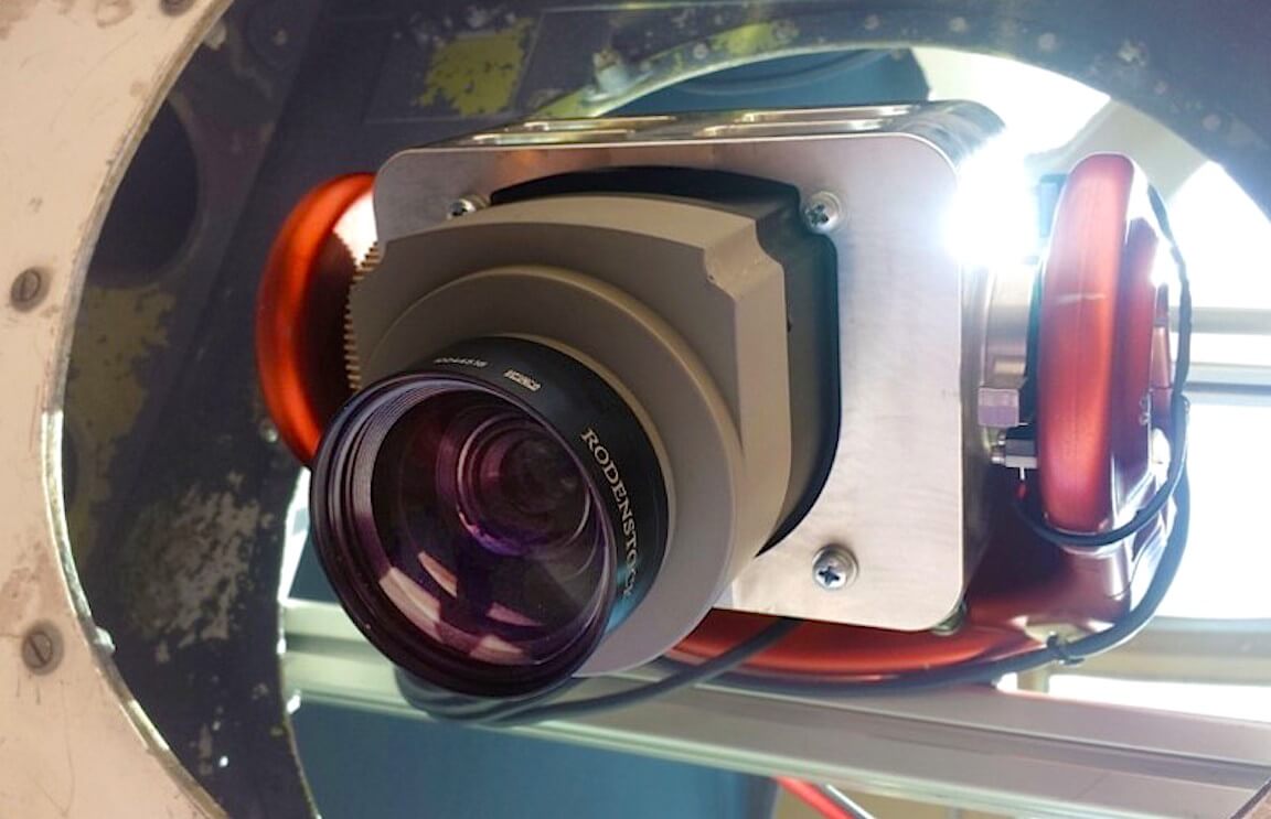
multi-sensor gimbal
We have a range of high performance gyro-stabilized single or dual LRU gimbal systems for Surveillance and Utility/Environmental Survey applications. Our electro-optical sensors are augmented with video processing and sophisticated image enhancement allowing users to see through conditions of fog, haze and low-light or darkness. Our inbuilt software can also blend images to exploit features from different sensors providing imagery of activities that otherwise would go undetected.
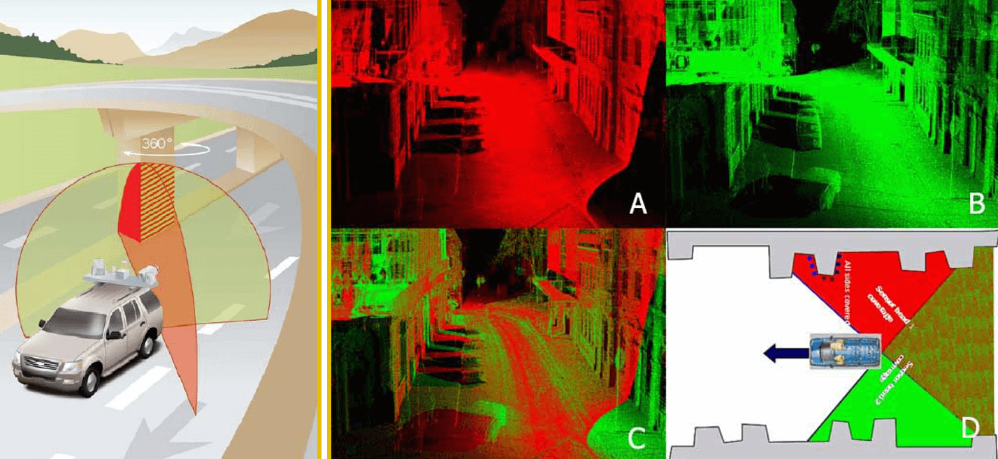
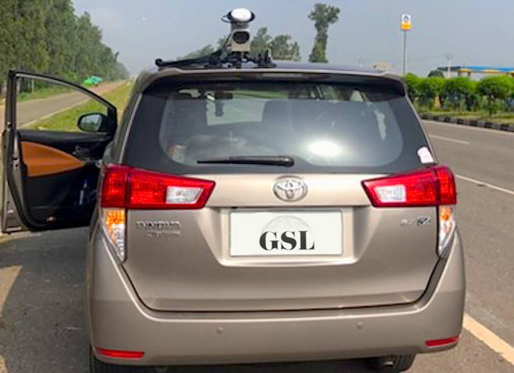
Network survey vehicle
Our robust multi-functional Network Survey Vehicle System(NSV) is based on the latest survey techniques utilizing Laser, Global Positioning System and Image processing tools. This can be used for automatic collection of road condition related data for Highways safety and Asset Management.
‣ Pavement surface roughness,
‣ Road geometric(s) (gradient, horizontal curvature, and cross slope)
‣ Rut Depth using Spread Lasers,
‣ Sensor Measure Texture Depth,
‣ Mean Profile Depth
‣ GPS Coordinates (X, Y, Z) viz. longitude, latitude & altitude etc.
‣ Roadside inventory and asset management
‣ Contractor quality control
‣ Airport runway maintenance
• • •
Select Projects


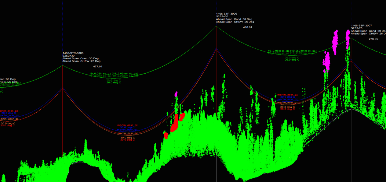
Aerial Patrolling of Power Transmission Lines
Fault Detection and Maintenance Audit
Aerial patrolling of EHV (132 kV AC/ 220 kV AC/ 400 kV AC/ 765 kV AC/ ± 500 kV HVDC/+/- 800 kV HVDC) Transmission lines using gyro stabilized gimbal mounted Themovision Camera, Corona Camera, High Definition Video Camera, Still photography camera and sensors for measurement of clearances along with Global Positioning System Receiver, Monitor, on board Recorder etc. installed on Helicopter.
‣ 20,000 kms
‣ Completed till date 20,000 kms
‣ Mechanical Faults
‣ Thermal Faults
‣ Excessive Corona Discharge
‣ ROW
‣ LiDAR data acquisition and processing


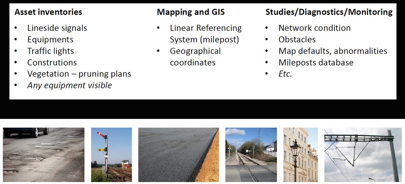
Road asset management
Pilot Project ~ 50kms
The primary goal of this assignment is to collect the data of entire National Highways. It is envisaged to build a single Road Database for National Highways. The deliverables for the project are mentioned below:
Location Referencing – linear and spatial
Road Inventory – including pavements, shoulders and side drains
Road Condition - including pavements, shoulders and side drains
Roughness as per International Roughness Index (IRI)
Pavement Structural Assessment
• • •
Contact Us
Alone we are smart.
Together we are brilliant.
GSL ASSOCIATES PVT LTD
3rd Floor, Building No. 2, Lane No. 1,
Westend Marg, Said-ul-Ajaib,
New Delhi - 110030
INDIA
T: +919953514231
info@gslgeo.com
Our Team

Prashant Jain
Serial entrepreneur and an avid traveller, Prashant brings to the table over 3 decades of experience in mining, coal transportation and waste recycling. Prashant has vast experience in setting and scaling up projects, managing investments and teams. He is deeply rooted in Indian culture and has proven experience of managing businesses in Asia, Middle East and EU

ofir bentov
Ofir has a vast wealth of experience in the 3D mapping, geoinformation and remote sensing fields. From establishing his first geomatics company in 2003; to having successfully executed projects at a highly complex level in Israel, the USA, Africa and India; to establishing along with Mr. Prashant Jain the technology arm of GSL. He holds a Masters degree with Excellence in Geo-information from Tel Aviv University. He was also engaged by the remote sensing lab at Tel Aviv University to research cutting edge technologies for the fusion of data from lidar and hyperspectral sensors.
A deep researcher and practitioner in hatha yoga, Ofir resides with his wife in the UK.

gautam jain
Gautam is a young and dynamic part of the team besides being a Director of the Company. He brings a wealth of interpersonal relationships and client management skills to the table. His forte is vetting agreements and contracts for the Company. He has presented the Company to various potential and current clients with meetings translating into business. Gautam has studied in the Middle East and the UK. He loves traveling and meeting people.